Catoctin/Fauquier contact

Catoctin/Fauquier contact
Power washing a quarry block near Aldie, VA that preserves a soft sediment contact of the Fauquier Formation cap carbonate and pillow basalt of the Catoctin Formation.

Thursday, February 9, 2012

The Melt Redemption


Fig.1 Mid-Ocean ridges are large mountain ranges
underwater, with intense heat activities
Where is the longest and largest mountain range in the world? Himalayas? Andes? No. It is under the sea. Known as Mid-Ocean Ridge, the huge underwater mountain system extends as long as 65000 km and connects the undersea mountains from Pacific to Atlantic, forming spectacular landscape in the midst of the vast seafloor. Mountaineers in the legendary kingdom of Atlantis, if this kingdom exists, might be excited to climb these mountains, but they’d better take good care of their feet, because mid-ocean ridges could be very hot. Black smokers with temperature ranging from 60 °C to as high as 464 °C have been discovered along mid-ocean ridges by deep-sea explorations. These heat and energy released by the black smokers are believed to have given birth to the life on Earth, and are closely related to the magma movement beneath mid-ocean ridges.

Like cut pie, the Earth’s surface is broken up into several pieces called plates, which move in relation with one another. Mid-ocean ridges, or tectonically known as divergent plate boundaries, are places where two plates are moving apart. The change of temperature and pressure in this process causes the rocks beneath mid-ocean ridges to melt and erupt and then solidify, forming new crust along mid-ocean ridges, and that is the mountain range we see under the sea. The axis of a mid-ocean ridge is always believed to be the exit for the upwelling melts to erupt. However, recent observations suggest that those naughty melts (or magma) have probably already found a secret passage to escape. Throughout the global mid-ocean ridge system, mid-ocean ridges are cut by huge fractures called transform faults. Previous theories believe that these fractures, with efficient cooling, may direct melts away, but recent research showed that there is thickened crust along transform faults, which indicates active magma activity in these regions.  

Hebert and Montesi (2011) apply a 3D model of melt movement to investigate the unusual thickened crust along an oceanic transform, and suggest that the faults and cracks in transform region might create connected channels and should be responsible for the melt redemption. In 2D, melt migration at mid-ocean ridge system can be modeled by a process with two steps: (1) vertical upwelling under buoyancy; (2) lateral migration along a low-permeability lid inclined towards the ridge axis. However, in 3D, the existence of the transform will affect the melt pathway to the ridge axis and result in thickened crust. Hebert and Montesi solve a 3D model based on a thermal structure that incorporates important parameters, and emphasize the potential structural controls on melt concentration in transform faults. Their results show that the structural damage such as faults and dikes, intersects the lid on the melt pathway, redistributes ridge crust to the transform domain, and accounts well for the unusual crustal thickness at transform faults observed. Their research gives a new perspective in the study of the origin of the huge mountain range under the sea, and can be used to explain the heat distribution along mid-ocean ridges, contributing to the efforts in unveiling the mysteries of this region.

Fig.2 Sketches for melt pathway beneath a ridge and a transform respectively. The melts are guided by a lid called permeability barrier and may be extracted by some structural damages to the surface, forming thickened crust


Reference

Hebert, L. B., and L. G. J. Montési (2011), Melt extraction pathways at seg- mented oceanic ridges: Application to the East Pacific Rise at the Siqueiros transform, Geophys. Res. Lett., 38, L11306, doi:10.1029/2011GL047206.

Of Meteorites and Mulch - Events of the Late Triassic

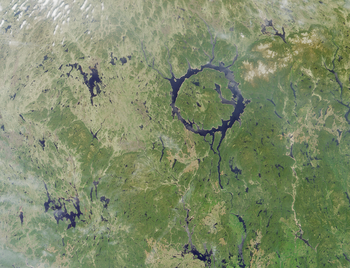
About 215 million years ago, a meteor smashed into eastern Canada, creating the Manicouagan crater, one of the largest ever discovered. What affect did this impact have on life? Meteorite impacts are often suggested as the cause of mass extinctions, the most notorious of which was responsible for ending the reign of the dinosaurs 65 million years ago. So far, this dinosaur destroying impact - the Chixulub crater on the Yucatan Peninsula - is the only crater to be directly linked to any extinction, big or small. The effects of the Manicouagan impact have yet to be found, but rocks in the southwestern United Startes are starting to change that.

Figure 1. Satellite image of the Manicouagan crater. Today, it forms a circular lake, 70 km in diameter, in northeaster Quebec, Canada. (Image by NASA)

The Chinle Formation is exposed throughout northern Arizona, southern Utah, southwestern Colorado, and northwestern New Mexico and represents river deposits from the Late Triassic. Scientists have been studying the rocks and fossils of the Chinle for over a century, especially in Petrified Forest National Park, but it was only in the last few years that the stratigraphy (the order in which rocks were deposited) was properly worked out. Once these rock layers were placed in the proper order, an interesting pattern developed. It was noticed that certain fossils only appeared in the upper part of the Chinle (younger rocks) while completely different fossils appeared in the lower part (older rocks) and that these two groups of fossils (called "faunas") were separated by a distinct, and geologically abrupt, layer. This layer, and therefore the transition between the two faunas, is represented by a thin layer (about 10 cm) of bright red, petrified "mulch". Geologists call this silcrete, because it is very hard, like concrete, and made up almost entirely of the mineral silicate. It occurs in a group of rocks called the Sonsela Member, which can be easily seen throughout the southern half of Petrified Forest.
Figure 2. The red silcrete cascades down the sides of rocky knolls as erosion wears away the underlying rock.


 Although many different fossil species are known throughout the Chinle Formation, the difference between the two faunas - named the Adamanian (below) and Revueltian (above) - is most striking in just two types of animals. Each fauna has its own species of phytosaur (large, crocodile-like animals) and its own species of aetosaur (large, armadillo-like animals), shown in figure 3. Fossils of these animals are abundant and therefore make it easy to distinguish which fauna is represented in which rocks. It is interesting to note that these animals get smaller as you pass from the Adamanian to the Revueltian. Several other animals show this pattern as well.

Figure 3. Phytosaurs (left) and aetosaurs (right) that represent the two faunas. The older (Adamanian) species are distinctly larger than their younger (Revueltian) counterparts. (Adapted from an image by Jeff Martz)
Figure 4. Chinle stratigraphy with ages, showing the
mulch layer in red (Adapted from a figure by Jeff Martz)

Once this pattern in the fossils was discovered, geologists and paleontologists started noticing other patterns. The rocks showed evidence of a steady increase in dry conditions, through changes in their chemical record and changes in the types of rocks. After the red silcrete layer, large beds of river mussels start to appear, most likely due to an increase in the alkalinity of the water. Changes in flora are also observed through a transition in the types of pollen found. And finally geologists have started to place absolute dates are several layers of the Chinle Formation due to the presence of a mineral called zircon. These dates place the red mulch layer and the turnover event between about 218 and 213 million years ago. This fits perfectly with the age of the Manicouagan impact at 215.5 Ma.

So, did the Manicouagan cause the change in fauna? the drying climate? Much more research still needs to be done before it can be said for certain. What other animals can we see this abrupt transition in? Did this event affect land predators like it affected the phytosaurs and aetosaurs? Can this even be seen else where in the United States? These are questions I plan to answer.

_______________________________
Martz, J. W. & W. G. Parker. 2010. "Revised lithostratigraphy of the Sonsela Member (Chinle Formation, Upper Triassic) in the southern part of Petrified Forest National Park, Arizona." PLoS ONE 5 (2)

Parker, W. G. & J. W. Martz. 2011. "The Late Triassic (Norian) Adamanian-Revueltian tetrapod faunal transition in the Chinle Formation of Petrified Forest National Park, Arizona." Earth and Environmental Science Transactions of the Royal Society of Edinburgh 101: 231-260

Ramezani, J., S. A. Bowring, M. S. Pringle, F. D. Winslow, & E. T. Rasbury. 2005. "The Manicouagan impact melt rock: a proposed standard for the intercalibration of U–Pb and 40Ar/39Ar isotopic systems." Geochimica et Cosmochimica Acta 69

Ramezani, J., G. D. Hoke, D. E. Fastovsky, S. A. Bowring, F. Therrien, S. I. Dworkin, S. C. Atchley, & L. C. Nordt. 2011. "High-precision U-Pb zircon geochronology of the Late Triassic Chinle Formation, Petrified Forest National Park (Arizona, USA): Temporal constraints on the early evolution of dinosaurs." Geological Society of America Bulletin

Taming of the Stream

Many of you may have noticed the large scale stream restoration that is occurring in Paint Branch Creek on the backside of campus (Figure 1). Something you may not know however is that all stream restorations are not created equal. Many restorations are done in order to create a more natural stream environment and reduce sediment erosion. If done properly and for the correct reasons restoration can be a valuable tool for returning to a more natural stream ecosystem. However when the goal of a restoration is simply to tame a stream and pin it in the current location for economic reasons, it may not be the best solution. You may be wondering why this restoration should matter to you. Restorations in and of themselves can be very expensive and if not successful in addition to that cost you may have increased costs for things like drinking water purification. While attempting to save the economic interests of business building along Route 1 this project could end up costing much more for people who are not directly involved.


Figure 1. There is heavy machinary in my stream!  Paint Branch where the restoration is occuring (personal photo).
In many areas of the country people have made a point to build on the natural floodplains, which is the land adjacent to the stream that can experience flooding during a storm event. The problem with building on a floodplain is that the new construction can be flooded during a storm event. This restoration project on Paint Branch aims to anchor the banks of the stream to prevent lateral migration, or movement of the stream left and right, this is important because construction has occurred so close to the stream. Some parking lots along route 1 had even begun to fall into the stream before the restoration began.
Rivers and streams in the United States provide crucial ecosystem services to humans; however our alterations of the natural landscape have become a major threat to stream water quality.  According to a water quality inventory done in 2000 by the Environmental Protection Agency, approximately one-third of U.S. rivers and streams are considered impaired or polluted. Due to this extensive degradation, billions are spent annually on stream restoration efforts. The quality of water in a stream is vastly influenced by the activities present in the watershed (Chiras, 2001).The large increase in urbanization in the Paint Branch Creek watershed has led to increased sediment erosion into the ecosystem. Stream channels have the ability to act as a sediment conveyor belt, effectively transporting materials from first smaller streams to larger ones (Maryland Streams: Take a Closer Look, 2005). Excess sediment in a stream, which is considered one of the major problems effecting water quality, can cause significant ecological degradation, by clogging streams, limit the light reaching stream organisms, and transporting excess nutrients and occasionally pollutants or toxins (Jastram et. al, 2009; Allan, 2004).The stream restoration occuring off campus appears to involve changing the shape of the stream banks and then anchoring them into place with large boulders. The goal of this type of restoration project is to stabilize the banks to resuce the amount of sediment eroded into the stream environment. 

I have two main concerns about this particular stream restoration. My first major concern has to do with the anchoring of the banks using large boulders. This process can cause a disconnect between the stream system and its floodplain. In a natural stream the surface water flowing through the stream can interact with water under the ground allowing for filtration of pollutants and sediment which improve the overall water quality. When a disconnect occurs the filtration is no longer possible and water quality can deteriorate. A disconnect can occur for several reasons including the boulders blocking the water interactions and because of stream incision, or deepening, which is a byproduct of the inability to migrate left and right and makes the ground water less accessible. The other concern I have with this project is that while the goal may be to reduce long term bank erosion, in the short run large amounts of sediment are being disturbed and transported downstream (Figure 2). At this time of year excess sediment can be especially problematic due to the fact that the ground is already so wet there is no room to store water, which normally would allow suspended sediment to settle out.
Figure 2. Which side would you rather live on? A sediment line showing the merger of Paint Branch (left) and Indian Creek (right) to form the North East Branch of the Anacostia River (personal photo).
This restoration is of importance to me because my master's thesis will involve looking at the suspended sediment in the NE Branch of the Anacostia and Paint Branch in order to determine if this type of restoration is even necessary. I plan to examine the system to see how much sediment is actually being transported and what areas of the stream are acting as sources and sinks for sediment. It is important to realize that what is happening in this small stretch of Pain Branch also effects other stream including the North East Branch of the Anacostia, the mainstem of the Anacostia, and possibly even the Chesapeake Bay. The USGS survey is already seeing an increased amount of sediment at its gage on the NE Branch (figure 3).
Figure 3. Spikes in sediment correspond with the hours of the day where work is being done on the restoration (water.usgs.gov).

It is by no means my job to judge the restoration effort taking place on Paint Branch Creek and in reality it is too soon to make a final judgement anyways. However, I wanted to point out the concerns I had about the project and why it is important to make sure a restoration is actually meeting its goals. Is this stream restoration helping the stream or harming it, I will leave that for you to decide.
Allan, J. D. "LANDSCAPES AND RIVERSCAPES: The Influence of Land Use on Stream Ecosystems." Annual Review of Ecology, Evolution, and Systematics 35.1 (2004): 257-84.

Bernhardt, E. S., M. A. Palmer, J. D. Allan, G. Alexander, K. Barnes, S. Brooks, J. Carr, S. Clayton, C. Dahm, J. Follstad-Shah, D. Galat, S. Gloss, P. Goodwin, D. Hart, B. Hassett, R. Jenkinson, S. Katz, G. M. Kondolf, P. S. Lake, R. Lave, J. L. Meyer, T. K. O'Donnell, L. Pagano, B. Powell, and E. Sudduth. "ECOLOGY: Synthesizing U.S. River Restoration Efforts." Science 308.5722 (2005): 636-37.

Craig, L.S., M.A. Palmer, D.C. Richardson, S. Filoso, E.S. Bernhardt, B.P. Bledsoe, M.W. Doyle, P.M. Groffman, B.A. Hassett, S.S. Kaushal, P.M. Mayer, S.M. Smith, P.R. Wilcock. 2008. Stream Restoration Strategies for Reducing River Nitrogen Loads. Frontiers in Ecology and the Environment, v. 6.
"Maryland Streams: Take a Closer Look." Maryland Department of Natural Resources. MDNR, May 2005. Web. 12 Dec. 2011. <http://www.dnr.state.md.us/irc/docs/00012830.pdf>.

Particle Accelerators in Geophysics


When one thinks of the standard tools geologists use to study the Earth, a particle accelerator is unlikely to come into mind. Nevertheless, Dr. Wenlu Zhu of the University of Maryland is using X-rays emitted by a particle accelerator to characterize the fluid transport properties of laboratory-made, partially molten rocks. The compositions of these rocks are akin to those found in the Earth’s mantle. Zhu proposes that three-dimensional analysis of the melt distribution of these synthetic mantle rocks will help geologists to better understand regional melting within the Earth. Her research focuses on ocean ridges, which are the divergent oceanic plate boundaries where magma erupts to form new crust. Zhu is the lead researcher on the project, which is a collaborative effort, involving scientists from the University of Maryland, Woods Hole Oceanographic Institute, and Argonne National Labs.

Figure 1: Arial view of the particle accelerator at Argonne National Labs, outside Chicago. The circumference of the ring is 1,104 m. The ring emits X-ray radiation radially outward from the ring.

Figure 2: The X-ray beam. X-ray radiation is outside the visible spectrum for humans. Oxygen in the air is ionized by the powerful X-ray beam.
Particle accelerators, such as the one at Argonne National Labs, use powerful electric fields to accelerate electrons in a circular path to within 99.999999% of the speed of this light. Because they move in a circle, the electrons experience a constant acceleration, causing them to radiate energy. This radiation is harnessed and focused into a beam that can be fired at the rock sample. Much like a CAT scan that one might receive at a doctor’s office, Zhu and her colleagues are able to see right through the hard, opaque layers of their rock sample. Each layer is recorded and digitally stored onto a computer hard drive. Zhu et al. perform a so-called numerical experiment using the data to simulate magma flowing through their samples. By doing this, they are able to quantify fluid properties of their samples, such as permeability. Permeability is defined as the capacity of their rock samples to allow fluid, in this case magma, to pass through it. Permeability is a fundamental property of the rock.

Figure3: Diagram of the imaging process. The monochromatic, or single wavelength light, is passed through the sample and collected by a scintillator. The function of the scintillator is to convert the X-ray radiation to visible light. The light is then focused onto a CCD camera and digitally recorded onto a hard drive.


Figure 4: Segmented image of the 3D melt structure. The solid in this figure corresponds to melt in the sample. The void space corresponds to places where olivine grains reside. Image is sampled form Zhu et al. (2011).
Preliminary results look promising. However, extrapolating the results of laboratory experiments to the Earth’s mantle may be challenging. So far, the only experiments that have been conducted have used a simple olivine-melt system. Although olivine is the major constituent of the mantle, there are other minerals present. Incorporating these additional minerals may significantly alter the fluid properties of the rocks. In addition to having compositional variety, the mantle is constantly bending and twisting. Convection currents in the solid, yet ductile, mantle cause these deformations, which may give way to drastically different melt structures. Experiments are currently being planned to investigate the role composition and deformation in the transportation of magma through mantle rocks.

X-ray radiation imaging is a useful tool for studying magmatic processes in the Earth. So far, research performed by Zhu and her colleagues has led to the first direct measurements of permeability for partially, molten mantle rocks. The methods used by Zhu et al. may help geologists better understand mantle melting elsewhere on the Earth, such as at subduction zones where volcanoes often form.

Zhu, W., Gaetani, G.A., Fusseis, F., Montési, L.G.J., De Carlo, F. (2011), Microtomography of Partially Molten Rocks:Three-Dimensional Melt Distribution in Mantle Peridotite, Science: 332 (6025) 88-91, [DOI:10.1126/science.1202221]. 

Could Europa Host Life?


The crisscrossed surface of Europa in 
true color (left) and false color (right). 
Courtesy of NASA/JPL. 


“Follow the water” is a common phrase used when searching for life in the Universe.  Scientists use the presence or absence of water to help evaluate the potential for life on planetary bodies.  If a target is thought to have water then NASA takes steps to protect it from Earth contamination (Planetary Protection).   The main evaluation for if a planet has the potential to host life is based on if it has water.  If there is no evidence for water, then the sterilization procedures for a mission are relaxed.

Europan ridge that may be formed by freezing water.  
Could provide conduit for water to the surface of Europa. 
Courtesy of NASA/JPL.
Europa is one of the planetary bodies that is protected under Planetary Protection procedures.  Europa is a moon with a surface predominantly covered with ice orbiting planet Jupiter.  The first mission to send back images of Europa’s surface was Voyager.  Voyager was launched in the 1970s to study the outer solar system and eventually interstellar space.  Higher resolution images were obtained by the 1989 Galileo mission, which was designed to study the Jovian system.  These images revealed in ice-covered surface resembling a ball of twine, covered with linear ridges.  Data from these missions also revealed that Europa generates its own magnetic field, which provides evidence that there is a briny ocean beneath the surface.

As the water intrusion freezes it exerts pressure in all 
directions and can cause upward flexure (red) and
 sideways compression and flexure (blue) to form a ridge.  
Pressure could crack the ice, allowing water-radiation reactions
 that could be favorable for life on Europa.
Europan ridges are of specific scientific interest because they not only reveal information about geologic processes but also the potential for the existence of shallow water. The interaction of water on Europa with the surface could have implications for the astrobiological potential of the icy satellite.  Jupiter’s magnetosphere  bombards the surface of orbiting moons with radiation.  If water on Europa reacts with the radiation it could produce chemicals that have the potential to nourish life in the water, similarly to how hydrothermal vents sustain life on the ocean floor. 


One hypothesis for Europan ridge formation is that shallow water intrusions within the ice shell could freeze and expand to create the surface features of the ridges.  As the water freezes and expands it exerts a significant amount of pressure on the surrounding ice and may create cracks within the ice in the same way that freezing water in pipes may cause them to burst in winter. These cracks could serve as a conduit for water to reach the surface and react with radiation.

In order to explore the hypothesis that freezing water in the ice could form ridges several questions must be answered.  How much pressure can the freezing water exert on the surrounding ice?   Is this pressure enough to crack the ice?  How deep can the water intrusion be and still be able to create these ridge features.  These questions are being evaluated currently through the use of computer-based models and may allow scientists to follow the water to life.

 References:
Cassidy, T., Coll, P., Raulin, F., Carlson, R. W., Johnson, R. E., Loeffler, M. J., Hand, K. P., et al. (2010). Radiolysis and Photolysis of Icy Satellite Surfaces: Experiments and Theory. Space Science Reviews153(1-4), 299-315. doi:10.1007/s11214-009-9625-3
Christopher F. Chyba and Cynthia B. Phillips. (2002). Europa as an Abode of Life. Origins of Life and Evolution of Biospheres (Vol. 32, pp. 46-47). doi:10.1111/j.1744-618X.2010.01158.x
Han, L., & Showman, A. P. (2008). Implications of shear heating and fracture zones for ridge formation on Europa. Geophysical Research Letters35(3), 6-10. doi:10.1029/2007GL031957

What the "frack" is going on with shale gas??


In the face of rising global energy demands and related greenhouse gas emissions, it is imperative of finding greener, alternative sources of energy that address these concerns. Natural gas, which burns more cleanly than other fossil fuels, emitting approximately half of the CO2 levels compared with the burning of coal and 30% less than fuel oil, is growing as an alternative fuel source.

Figure 1. Underground sources of natural gas.
Certain underground rock formations have historically been viewed as "unconventional" gas resources because of the difficulty in accessing and extracting the gas they contain.  Examples of these formations include: coalbed methane, tight sand gas, and gas-rich shale (Figure 1).
                    
Figure 2. Black shale rocks.
Approximately 60% of  the U.S. onshore gas reserve
is trapped  in  rocks like this.


Organic-rich shale rocks are known to retain an immense volume of natural gas on the grains and within the extremely small pore spaces of its structure, much like a sponge holds water. 


Current technological advances in drilling and fracture stimulation technology (e.g. hydraulic fracturing) have successfully enhanced access to the trapped gas within the tight rocks, turning shale into a more economically viable energy source.Chesapeake Energy hydraulic fracturing method 

Figure 3. Diagram of shale gas extraction.

Figure 4. U.S. EIA (Energy Information Administration) Projections. 


Because of advances like these, by 2035, it is projected that shale gas will contribute to almost half of natural gas production in the U.S. (Figure 4.)


However, numerous questions and concerns are arising regarding the environmental effects of such practices, with particular concern of the hydraulic fracturing fluids used to extract the gas.  What are the chemicals in the “frack” fluids?  How do these fluids interact with the shale rock?  What will happen to the integrity of the shale reservoir and surrounding rocks over time?  Will residual fluids left underground become trapped within the fractures and pore spaces, ultimately inhibiting further natural gas generation or extraction over time?

My work ultimately aims to determine the chemical and physical interactions of different types of fracking fluids on shale rock formations and determine their impact on gas recovery efficiency.  A more complete and quantitative understanding of the impacts of hydraulic fracturing fluids in shale reservoirs is imperative if we are to continue to depend on natural gas as a major energy resource.

References:
http://geology.com/rocks/shale.shtml (Figure 2)
http://www.bbc.co.uk/news/uk-wales-14352989   (Figure 3)
http://www.eia.gov/naturalgas/
http://www.naturalgas.org/overview/unconvent_ng_resource.asp

U.S. Department of Energy (DOE), Office of Fossil Energy and National Energy Technology
Laboratory, 2009.  Modern Shale Gas Development in the United States: A Primer. 
DE-FG26-04NT15455.3-5.

Hidden Secrets in Tiny Niches: From Jurassic Park to Fluid Inclusions.


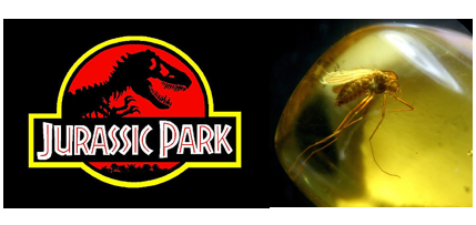
People that have seen the science-fiction film Jurassic Park must still remember that in the film, the eccentric billionaire created a theme park populated with dinosaurs cloned from the DNA extracted from mosquitoes preserved in prehistoric amber(Fig. 1 )
Fig.1. In the science-fiction film Jurassic Park, scientists  extracted the dinosaur DNA from prehistoric amber, and then cloned dinosaurs in modern world.


Similar with extracting the dinosaur DNA from amber, geologist find out they can also extracting the paleotemperature from fluid inclusions(Fig. 2 ) preserved in the precipitated mineral crystals!
Fig. 2 These are fluid inclusions in calcite crystals in Tarim basin, NW China. The paleogeofluid was trapped in the crystals ,thus provides geologists a great opportunity to extract temperature information from them.

In the remote NW China, petroleum geologist found intense paleogeofluid activities in the old rocks. To figue out the paleotemperature of these fluid flows is significant to the petroleum exploration there.
Fig.3 The measuring process of melting and homogenization temperatures of fluid inclusions. The measured homogenization temperature represents the simultaneous temperature of the fluids at that time. With the measured melting temperatures we can calculate the salinity of the fluids.

Using the cooling and heating stage, we first freeze the fluid inclusions into a supercooled status, and then slowly warm them until the gas bubble in the  fluid inclusions disappear. At that time, the gas and the liquid phases homogenize into one phase. The temperature of this disappearing point is just the very paleotemperature of these fluid flows that traped in the  fluid inclusions (Fig.3). Finally, we geologists succeed to get the temperature information! With this important information, it will be easier for the petroleum geologists to find out more oil!