Catoctin/Fauquier contact

Catoctin/Fauquier contact
Power washing a quarry block near Aldie, VA that preserves a soft sediment contact of the Fauquier Formation cap carbonate and pillow basalt of the Catoctin Formation.

Thursday, February 9, 2012

Could Europa Host Life?


The crisscrossed surface of Europa in 
true color (left) and false color (right). 
Courtesy of NASA/JPL. 


“Follow the water” is a common phrase used when searching for life in the Universe.  Scientists use the presence or absence of water to help evaluate the potential for life on planetary bodies.  If a target is thought to have water then NASA takes steps to protect it from Earth contamination (Planetary Protection).   The main evaluation for if a planet has the potential to host life is based on if it has water.  If there is no evidence for water, then the sterilization procedures for a mission are relaxed.

Europan ridge that may be formed by freezing water.  
Could provide conduit for water to the surface of Europa. 
Courtesy of NASA/JPL.
Europa is one of the planetary bodies that is protected under Planetary Protection procedures.  Europa is a moon with a surface predominantly covered with ice orbiting planet Jupiter.  The first mission to send back images of Europa’s surface was Voyager.  Voyager was launched in the 1970s to study the outer solar system and eventually interstellar space.  Higher resolution images were obtained by the 1989 Galileo mission, which was designed to study the Jovian system.  These images revealed in ice-covered surface resembling a ball of twine, covered with linear ridges.  Data from these missions also revealed that Europa generates its own magnetic field, which provides evidence that there is a briny ocean beneath the surface.

As the water intrusion freezes it exerts pressure in all 
directions and can cause upward flexure (red) and
 sideways compression and flexure (blue) to form a ridge.  
Pressure could crack the ice, allowing water-radiation reactions
 that could be favorable for life on Europa.
Europan ridges are of specific scientific interest because they not only reveal information about geologic processes but also the potential for the existence of shallow water. The interaction of water on Europa with the surface could have implications for the astrobiological potential of the icy satellite.  Jupiter’s magnetosphere  bombards the surface of orbiting moons with radiation.  If water on Europa reacts with the radiation it could produce chemicals that have the potential to nourish life in the water, similarly to how hydrothermal vents sustain life on the ocean floor. 


One hypothesis for Europan ridge formation is that shallow water intrusions within the ice shell could freeze and expand to create the surface features of the ridges.  As the water freezes and expands it exerts a significant amount of pressure on the surrounding ice and may create cracks within the ice in the same way that freezing water in pipes may cause them to burst in winter. These cracks could serve as a conduit for water to reach the surface and react with radiation.

In order to explore the hypothesis that freezing water in the ice could form ridges several questions must be answered.  How much pressure can the freezing water exert on the surrounding ice?   Is this pressure enough to crack the ice?  How deep can the water intrusion be and still be able to create these ridge features.  These questions are being evaluated currently through the use of computer-based models and may allow scientists to follow the water to life.

 References:
Cassidy, T., Coll, P., Raulin, F., Carlson, R. W., Johnson, R. E., Loeffler, M. J., Hand, K. P., et al. (2010). Radiolysis and Photolysis of Icy Satellite Surfaces: Experiments and Theory. Space Science Reviews153(1-4), 299-315. doi:10.1007/s11214-009-9625-3
Christopher F. Chyba and Cynthia B. Phillips. (2002). Europa as an Abode of Life. Origins of Life and Evolution of Biospheres (Vol. 32, pp. 46-47). doi:10.1111/j.1744-618X.2010.01158.x
Han, L., & Showman, A. P. (2008). Implications of shear heating and fracture zones for ridge formation on Europa. Geophysical Research Letters35(3), 6-10. doi:10.1029/2007GL031957

What the "frack" is going on with shale gas??


In the face of rising global energy demands and related greenhouse gas emissions, it is imperative of finding greener, alternative sources of energy that address these concerns. Natural gas, which burns more cleanly than other fossil fuels, emitting approximately half of the CO2 levels compared with the burning of coal and 30% less than fuel oil, is growing as an alternative fuel source.

Figure 1. Underground sources of natural gas.
Certain underground rock formations have historically been viewed as "unconventional" gas resources because of the difficulty in accessing and extracting the gas they contain.  Examples of these formations include: coalbed methane, tight sand gas, and gas-rich shale (Figure 1).
                    
Figure 2. Black shale rocks.
Approximately 60% of  the U.S. onshore gas reserve
is trapped  in  rocks like this.


Organic-rich shale rocks are known to retain an immense volume of natural gas on the grains and within the extremely small pore spaces of its structure, much like a sponge holds water. 


Current technological advances in drilling and fracture stimulation technology (e.g. hydraulic fracturing) have successfully enhanced access to the trapped gas within the tight rocks, turning shale into a more economically viable energy source.Chesapeake Energy hydraulic fracturing method 

Figure 3. Diagram of shale gas extraction.

Figure 4. U.S. EIA (Energy Information Administration) Projections. 


Because of advances like these, by 2035, it is projected that shale gas will contribute to almost half of natural gas production in the U.S. (Figure 4.)


However, numerous questions and concerns are arising regarding the environmental effects of such practices, with particular concern of the hydraulic fracturing fluids used to extract the gas.  What are the chemicals in the “frack” fluids?  How do these fluids interact with the shale rock?  What will happen to the integrity of the shale reservoir and surrounding rocks over time?  Will residual fluids left underground become trapped within the fractures and pore spaces, ultimately inhibiting further natural gas generation or extraction over time?

My work ultimately aims to determine the chemical and physical interactions of different types of fracking fluids on shale rock formations and determine their impact on gas recovery efficiency.  A more complete and quantitative understanding of the impacts of hydraulic fracturing fluids in shale reservoirs is imperative if we are to continue to depend on natural gas as a major energy resource.

References:
http://geology.com/rocks/shale.shtml (Figure 2)
http://www.bbc.co.uk/news/uk-wales-14352989   (Figure 3)
http://www.eia.gov/naturalgas/
http://www.naturalgas.org/overview/unconvent_ng_resource.asp

U.S. Department of Energy (DOE), Office of Fossil Energy and National Energy Technology
Laboratory, 2009.  Modern Shale Gas Development in the United States: A Primer. 
DE-FG26-04NT15455.3-5.

Hidden Secrets in Tiny Niches: From Jurassic Park to Fluid Inclusions.


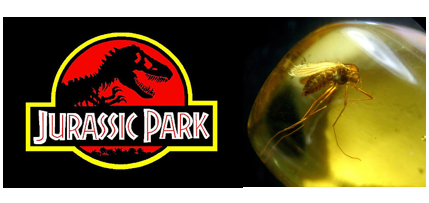
People that have seen the science-fiction film Jurassic Park must still remember that in the film, the eccentric billionaire created a theme park populated with dinosaurs cloned from the DNA extracted from mosquitoes preserved in prehistoric amber(Fig. 1 )
Fig.1. In the science-fiction film Jurassic Park, scientists  extracted the dinosaur DNA from prehistoric amber, and then cloned dinosaurs in modern world.


Similar with extracting the dinosaur DNA from amber, geologist find out they can also extracting the paleotemperature from fluid inclusions(Fig. 2 ) preserved in the precipitated mineral crystals!
Fig. 2 These are fluid inclusions in calcite crystals in Tarim basin, NW China. The paleogeofluid was trapped in the crystals ,thus provides geologists a great opportunity to extract temperature information from them.

In the remote NW China, petroleum geologist found intense paleogeofluid activities in the old rocks. To figue out the paleotemperature of these fluid flows is significant to the petroleum exploration there.
Fig.3 The measuring process of melting and homogenization temperatures of fluid inclusions. The measured homogenization temperature represents the simultaneous temperature of the fluids at that time. With the measured melting temperatures we can calculate the salinity of the fluids.

Using the cooling and heating stage, we first freeze the fluid inclusions into a supercooled status, and then slowly warm them until the gas bubble in the  fluid inclusions disappear. At that time, the gas and the liquid phases homogenize into one phase. The temperature of this disappearing point is just the very paleotemperature of these fluid flows that traped in the  fluid inclusions (Fig.3). Finally, we geologists succeed to get the temperature information! With this important information, it will be easier for the petroleum geologists to find out more oil!

Chemical differentiation of the silicate earth: insights from the distribution of the element Eu


    The formation of the Earth’s continental crust is one of the main outcomes of planetary differentiation. The composition of the crust provides insights into how the crust formed. It’s been generally agreed that the Earth continental crust was extracted from the mantle billions of years ago. During these processes, incompatible elements were removed from the mantle and preferentially partitioned into the continental crust, leaving the residual mantle depleted. Thus the knowledge of elemental distribution and fractionation may improve our understanding of the Earth differentiation and evolution.

Fig. 1 Cross section of the Earth. The layered structure of the Earth results from a series of physical and chemical differentiation.

    REE (rare earth element) is a group of elements that behave quite similarly to each other. Significant REE fractionation only occurs under certain circumstances. The REE abundance pattern is thus very useful to indicate geological processes. Contrary to all other REEs, which are trivalent elements (except Ce4+), Eu is unique in that it can also exist in the reduced (2+) valence state under reducing conditions. This feature, therefore, makes Eu easily fractionated from other REEs during Earth chemical differentiation, as divalent Eu is generally more compatible than other trivalent REEs, and may be stuck in the depleted mantle.
    The REE abundance pattern of the upper continental crust has, on average, a negative Eu anomaly (Eu is depleted relative to its neighboring rare earth elements). Some models for the composition of the bulk continental crust also indicate a negative Eu anomaly. However, to precisely constrain the Eu abundance relative to other REEs has often proved formidable by crustal sampling alone. Assume the bulk Silicate Earth (SE) has no Eu anomaly, that is, Eu anomaly is absent in the combination of the continental crust and depleted mantle. The depleted upper mantle, as a chemically complementary reservoir to the continental crust, provides a potential approach to unraveling this issue. Huge amount of basaltic magma erupts along the mid-ocean ridges–spreading centers of plate tectonics. These basalts are known as mid-ocean ridge basalts (MORBs), which came directly from the depleted mantle. MORBs thus open the window for studying the depleted mantle. My study will focus on MORB glasses from the Atlantic Ocean, Pacific Ocean and Indian Ocean, and examine whether the depleted mantle holds excessive Eu.

Fig. 2 Sampling locations of my research cover the mid-ocean ridges of the Pacific Ocean, Atlantic Ocean and Indian Ocean.

Tuesday, February 7, 2012

Walk a Mile in My Shoes -The Life of a Forensic Geologist


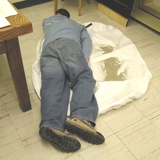
"Every contact leaves a trace." This is the mantra repeated by forensic geologists around the globe and was first postulated by 20th century scientist Edmond Locard, director of the first crime laboratory in Lyon, France. Trace evidence is any type of material left at or taken from a crime scene, or the result of contact between two objects, such as shoes and the floor or soil.

Figure 1: Forensic geologists deal with many mediums including shoes, bags of sediment, clothing, and rocks & minerals.

Forensic geology applies geological principles and analytical techniques to aid in solving criminal and legal investigations. It was first introduced to popular culture by Arthur Conan Doyle in the Sherlock Holmes novels, where Holmes was able to identify where a suspected individual had been based on the composition of clay on the bottom of his shoes.


Although seemingly unfamiliar to most people, forensic geology is largely prevalent in the news. Recent examples include Forensic Geologist Maureen Bottrell testifying at the Casey Anthony trial. Bottrell analyzed soil material found in the trunk of Anthony's car as well as several pairs of Anthony's shoes to determine whether a link could be made between the collected sediment and possible burial site of the deceased toddler, Caylee. Other local examples include a recent string of robberies and murders over expensive shoes in the D.C. metro area.

Figure 2: This demonstrative scene shows the many sources of evidence available at a crime scene, including material attached to the bottom of a victim's shoes.

My research follows the recent crime in our area. I will be taking several pairs of shoes, of varying tread size, and walk around selected areas; I am interested in observing the characteristics of the material that is transferred from the scene of interest to the footwear. These transferred sediments will then be compared with bulk soil samples from the area to determine if and how material is preferentially transferred based on shoe tread size. The aim of my research is to increase the efficiency and accuracy of trace evidence analysis with respect to geological materials. I am focusing on using cost-effective, practical analyses that may readily be used in laboratories across the world.

Thursday, February 2, 2012

A Late Triassic Faunal Transition and Associated Events

Figure 1. Chinle Formation stratigraphy in southern Petrified Forest National Park with approximate ages. (Adapted from a figure by Jeff Martz)

Recent revisions in the stratigraphy of the Chinle Formation along with more precise documentation of vertebrate fossil occurrences have revealed a distinct faunal transition, which coincides with several other biologic and geologic events. The Chinle Formation is exposed throughout northern Arizona, southern Utah, southwestern Colorado, and northwestern New Mexico and represents river deposits from the Late Triassic.  Although the event was first identified in Petrified Forest National Park (PEFO), it can be identified throughout the Chinle. It has not yet been identified outside of the southwestern United States. Lithologically, the transition is represented by a layer of bright red, petrified "mulch", known as the "persistent red silcrete zone" (PRSZ). This layer occurs only a few meters above the base of the Jim Camp Wash beds in the Sonsela Member of the Chinle Formation. It is most easily observed in the southern half of PEFO, where the Sonsela Member is widely exposed.

Figure 2. The persistent red silcrete zone in the Jim Camp Wash beds near the Painted Desert Museum of Petrified Forest National Park. (Photo by Susan Drymala)

The transition divides two distinct biostratigraphic units (biozones), defined by phytosaur taxa, with 'Leptosuchus' only occurring below the turnover level (defining the Adamanian biozone) and Pseudopalatus only occurring above (defining the Revueltian biozone). As large, robust, river dwelling animals, phytosaurs were easily preserved in the fossil record, especially their squamosals (large, knob-shaped bones at the back of the skull, useful in identifying species). Aetosaurs also show a distinct turnover at the Adamanian-Revueltian boundary and are represented by abundant fossils (primarily their armor plates - a.k.a. osteoderms - which are also useful in species identification). Although there are many species of aetosaurs present throughout the Chinle Formation Calyptosuchus and Typothorax can be used to identify the Adamanian and Revueltian, respectively. The boundary can be identified through patterns in other vertebrates as well, but phytosaurs and aetosaurs are the most densely sampled, especially at stratigraphic intervals directly above and below the transition zone, suggesting that the turnover represents a real event rather than an affect of sampling bias.

Figure 3. Phytosaur (left) and aetosaur (right) taxa representative of the two biozones. (Adapted from an image by Jeff Martz)
Although the Adamanian-Revueltian was first observed in vertebrate fossils, several other transitions have now been identified. Lithology and isotope records suggest a steady drying of the climate over this period, which may be due to the slow movement of the North American continent northward, away from the equatorial zone. The Revueltian shows an increase in well-developed paleosols and pedogenic carbonate nodules, compared to the Adamanian. This coincides with the appearance of large beds of unionid bivalves (known today as river mussels) which are known to prefer relatively alkaline waters. These beds only appear above the PRSZ of the Jim Camp Wash beds. A turnover in flora has also been identified, represented by the transition from Pollen Zone II to Pollen Zone III. Current absolute ages (U-Pb ages from detrital zircons) for Chinle strata place the persistent red silcrete zone and the Adamanian- Revueltian boundary between about 218 (lower Rainbow Forest Bed) and 214 Ma (middle Jim Camp wash beds). A cause for the event has not yet been identified, but some possibilities exist. Interestingly, the Manicouagan bolide impact in Quebec, Canada occurred at 215.5 Ma, although it currently cannot be directly tied to the Adamanian-Revueltian turnover.

_______________________________
Martz, J. W. & W. G. Parker. 2010. "Revised lithostratigraphy of the Sonsela Member (Chinle Formation, Upper Triassic) in the southern part of Petrified Forest National Park, Arizona." PLoS ONE 5 (2)

Parker, W. G. & J. W. Martz. 2011. "The Late Triassic (Norian) Adamanian-Revueltian tetrapod faunal transition in the Chinle Formation of Petrified Forest National Park, Arizona." Earth and Environmental Science Transactions of the Royal Society of Edinburgh 101: 231-260

Ramezani, J., S. A. Bowring, M. S. Pringle, F. D. Winslow, & E. T. Rasbury. 2005. "The Manicouagan impact melt rock: a proposed standard for the intercalibration of U–Pb and 40Ar/39Ar isotopic systems." Geochimica et Cosmochimica Acta 69

Ramezani, J., G. D. Hoke, D. E. Fastovsky, S. A. Bowring, F. Therrien, S. I. Dworkin, S. C. Atchley, & L. C. Nordt. 2011. "High-precision U-Pb zircon geochronology of the Late Triassic Chinle Formation, Petrified Forest National Park (Arizona, USA): Temporal constraints on the early evolution of dinosaurs." Geological Society of America Bulletin

Stream Restoration: Helpful or Harmful?


Many of you may have noticed the large scale stream restoration that is occurring in Paint Branch Creek on the backside of campus (Figure 1). A restoration is defined as returning the stream to a close approximation of its pre-disturbed condition. When I see a restoration of this magnitude I wonder is this helping or causing more harm to the stream? Rivers and streams in the United States provide crucial ecosystem services to humans; however our alterations of the natural landscape have become a major threat to stream water quality.  According to a water quality inventory done in 2000 by the Environmental Protection Agency, approximately one-third of U.S. rivers and streams are considered impaired or polluted. Due to this extensive degradation, billions are spent annually on stream restoration efforts.

Figure 1. Restoration efforts in Paint Branch Creek above campus (McDowell, 2012).
The stream restoration occurring off campus appears to involve changing the shape of the stream banks and then anchoring them into place with large boulders. The goal of this type of restoration project is to stabilize the banks to reduce the amount of sediment eroded into the stream environment. Sediment is considered to be one of the major problems effecting water quality in the United States, it can clog streams, limit light reaching stream organisms, and carry toxic pollutants. In this area, our streams drain into the Chesapeake Bay which has problems with excessive suspended sediment (sediment in the water column). This restoration is of importance to me because my master's thesis will involve looking at the suspended sediment in the NE Branch of the Anacostia and Paint Branch in order to determine if this type of restoration is even necessary. I plan to examine the system to see how much sediment is actually being transported and what areas of the stream are acting as sources and sinks for sediment. Another goal of anchoring the banks in a stream restoration is to prevent lateral migration, or movement of the stream left and right, this is important in streams like Paint Branch where construction has occurred so close to the stream. Some parking lots along route 1 had even begun to fall into the stream before the restoration began.


Figure 2. The sediment line showing the merging of Paint Branch Creek and Indian Creek to form the NE Branch of the Anacostia (McDowell, 2012).
You may be wondering how something that stabilizes the banks from erosion and prevents parking lots and building from falling into a stream could be considered anything but good, however I have two main concerns about this particular stream restoration. My first major concern has to do with the anchoring of the banks using large boulders. This process can cause a disconnect between the stream system and its floodplain, which is the land adjacent to the stream that can experience flooding during a storm event. This disconnect occurs due to the direct application of the boulders and because of stream incision, or deepening, which is a byproduct of the inability to migrate left and right. The connection between a stream channel and its floodplain is important because it allows the surface water in the stream to interact with the groundwater in the floodplain. This can facilitate filtration or sediment and toxic substances from the stream improving the overall water quality.
The other concern I have with this project is that while the goal may be to reduce long term bank erosion in the short run large amounts of sediment are being disturbed and transported downstream (Figure 2). This sediment will not only affect Paint Branch Creek but also the North East Branch of the Anacostia, the mainstem of the Anacostia, and possibly even the Chesapeake Bay. At this time of year excess sediment can be especially problematic due to the fact that the ground is already so wet there is no room to store water, which normally would allow suspended sediment to settle out. It is by no means my job to judge the restoration effort taking place on Paint Branch Creek and in reality it is too soon to make a final judgement anyways. However, I wanted to point out the concerns I had about the project and why it is important to make sure a restoration is actually meeting its goals. Is this stream restoration helping the stream or harming it, I will leave that for you to decide.

Allan, J. D. "LANDSCAPES AND RIVERSCAPES: The Influence of Land Use on Stream Ecosystems." Annual Review of Ecology, Evolution, and Systematics 35.1 (2004): 257-84.

Bernhardt, E. S., M. A. Palmer, J. D. Allan, G. Alexander, K. Barnes, S. Brooks, J. Carr, S. Clayton, C. Dahm, J. Follstad-Shah, D. Galat, S. Gloss, P. Goodwin, D. Hart, B. Hassett, R. Jenkinson, S. Katz, G. M. Kondolf, P. S. Lake, R. Lave, J. L. Meyer, T. K. O'Donnell, L. Pagano, B. Powell, and E. Sudduth. "ECOLOGY: Synthesizing U.S. River Restoration Efforts." Science 308.5722 (2005): 636-37.

Craig, L.S., M.A. Palmer, D.C. Richardson, S. Filoso, E.S. Bernhardt, B.P. Bledsoe, M.W. Doyle, P.M. Groffman, B.A. Hassett, S.S. Kaushal, P.M. Mayer, S.M. Smith, P.R. Wilcock. 2008. Stream Restoration Strategies for Reducing River Nitrogen Loads. Frontiers in Ecology and the Environment, v. 6.